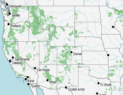
Quick Map I made in TileMill during my time at the Urban Ecology Institute.
In this map I used TileMill’s location functionality for the first time. This lets you click on a part of the map and have it linked to a URL and thus open a website. In my case I wanted to link the different US Forestry Service areas to their specific pages. At first i tried using the existing name field in the attribute table of the file and setting it to come after http://www.fs.usda.gov/{{{ForestName}}} however while most of the forest’s websites use this naming convention for their website, not all do. Some have abbreviations, others are in completely different formats.
I was hoping to find a more elegant solution, but the easiest way was to pull the links from the USFS website using the chrome extension Linkclump (Git). The urls were then moved into a csv file. The file was then joined to the USFS forest file and a new attribute Website was created with the URLs for each. It works nicely, if I do say so my self and you can test it out here.
